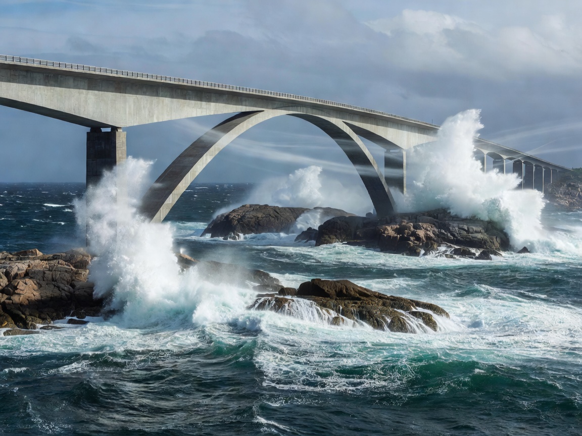
The Coastal Transition Zone
While the classic Norwegian fjord experience is defined by sheer vertical walls of granite and deep sheltered water, the outer rim presents an entirely different optical dynamic. Here, where fjords meet the North Atlantic, the landscape levels into a low-lying archipelago of wave-scoured skerries. The Atlantic Ocean Road (County Road 64) navigates this marine wilderness between Karvåg on Averøy and Vevang in Hustadvika municipality.
Opened in 1989 across eight separate bridges spanning 8,274 metres, the road was declared the "Norwegian Construction of the Century" in 2005. Unlike high mountain lookouts where the viewer stands hundreds of metres above the water, Atlanterhavsveien brings the traveller within metres of sea level, offering a dramatic side-view of oceanic swells colliding with reinforced causeway foundations.
Bridge Architecture: The Storseisundet Optical Illusion
The centerpiece of the route is Storseisundet Bridge (Storseisundbrua), a cantilever bridge measuring 260 metres in length with a main span of 130 metres. Built with a pronounced curve and three-dimensional twist, the bridge produces a celebrated visual paradox when approached from the mainland side: from certain roadway angles, the apex appears to terminate abruptly in mid-air, dropping straight into the ocean.
| Bridge Structure | Total Length | Clearance Below | Structural Form |
|---|---|---|---|
| Storseisundet Bridge | 260 metres | 23 metres | Cantilever concrete beam with curvature |
| Hulvågen Bridges (3 spans) | 293 metres combined | 3.5–4.0 metres | Low-profile post-tensioned beam |
| Vevangstraumen Bridge | 119 metres | 10 metres | Prestressed concrete box girder |
| Myrbærholmbrua | 147 metres | 13 metres | Integrated pedestrian angling platforms |
To capture the side profile of Storseisundet Bridge, the best vantage point is located on the adjacent islet of Eldhusøya. Here, the National Tourist Routes program constructed an elevated circular walkway made of composite grates resting on slender galvanized steel stilts, allowing visitors to circumnavigate the islet without disturbing the fragile sub-maritime vegetation.
Meteorological Conditions & Hustadvika Seas
The stretch of water bordering the road—the Hustadvika ocean expanse—is historically documented as one of the most perilous shipping passages along the Norwegian coast. During autumn and winter storms (September through February), north-westerly gales drive massive open-ocean breakers directly across the low causeway riprap.
Route Evaluation: Strengths & Limitations
- Year-Round Operational Access: As a sea-level coastal road, Atlanterhavsveien remains open throughout the winter without seasonal closures, though temporary gale restrictions may apply.
- Dedicated Walking Infrastructure: The suspended pathway at Eldhusøya is fully wheelchair and stroller accessible, featuring integrated service amenities and viewing cafes.
- Saltwater Spray Corrosion: High winds regularly cast dense salt brine over passing vehicles; a thorough undercarriage wash is strongly recommended after visiting during windy spells.
- Brief Driving Distance: The scenic bridge segment itself is relatively short (under 15 minutes of uninterrupted driving), requiring integration into a larger regional circuit.
Photographic Advice for the Outer Coast
For side-profile photography of the bridges, side-lighting during sunset (between 21:00 and 23:00 during June and July) casts a pink and orange glow on the northern curved concrete girders. When high winds prevail, positioning on the leeward observation platform at Eldhusøya provides stable tripod support while isolating the crashing waves against the bedrock.