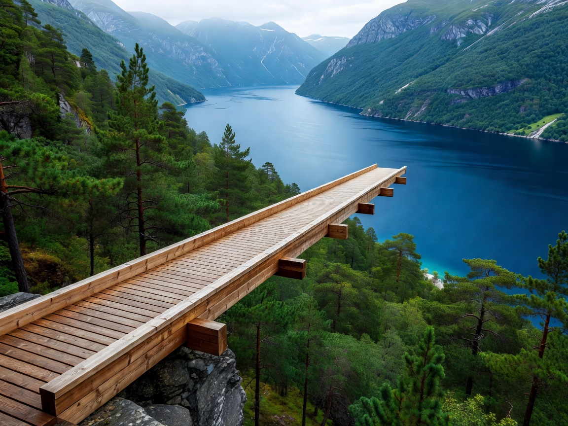
The Structural Wonder Above Aurland
Aurlandsfjord, a 29-kilometre-long branch of Sognefjorden (Norway’s longest and deepest fjord), is flanked by precipitous mountain massifs rising directly from the waterline. Before the opening of the 24.5-kilometre Lærdal Tunnel in 2000, traffic between Aurlandsvangen and Lærdalsøyri traversed County Road 243 (Fv243)—known colloquially as Snøvegen (The Snow Road).
In 2006, the Norwegian Public Roads Administration unveiled Stegastein along the lower third of this ascent. The viewing pier extends 30 metres horizontally outward from the hillside, hanging 650 metres in free air above the fjord. The architecture avoids traditional steel lattice trusses, opting instead for a continuous ribbon of solid laminated timber that bends smoothly downward to form an inclined end-wall of frameless tempered glass.
Side-View Dynamics and Optical Geometry
Unlike fjord-head lookouts that face broad open bays, Stegastein is situated along an inward flank of Aurlandsfjord. This position provides an authoritative side-view across to the mountain spine dividing Aurlandsfjord from the UNESCO-inscribed Nærøyfjord.
Photographically, the viewpoint yields dramatic perspectives when morning inversion fog fills the canyon floor, leaving only the dark pine crowns and the timber structure breaking the cloud blanket. During late afternoon, horizontal light strikes the eastern rock walls, generating high-contrast reflections across the navy-blue water below.
Technical Specifications of the Stegastein Installation
| Design Feature | Measurement / Specification | Operational Function |
|---|---|---|
| Cantilever Reach | 30 metres (98.4 ft) | Pushes observer past mountain tree line |
| Vertical Elevation | 650 metres above fjord level | High aerial perspective of vessel traffic |
| Platform Width | 4 metres (13.1 ft) | Accommodates concurrent two-way pedestrian movement |
| Primary Material | Solid Scots pine glulam, steel core, glass | Weather-treated natural weathering aesthetic |
| Terminal Barrier | Inclined structural glass pane | Removes visual boundary at the precipice |
Driving Logistics & Passing Bay Protocol
The 8-kilometre climb from the town of Aurlandsvangen to Stegastein consists of single-track asphalt with numerous tight hairpin bends. While the gradient is manageable for standard passenger cars, large RVs and motorhomes regularly create gridlocks because meeting oncoming traffic necessitates reversing to the nearest designated passing bay ("M" sign).
Route Evaluation: Highs and Lows
- Unrestricted Year-Round Access to Lookout: While the upper mountain pass across Aurlandsfjellet is sealed during winter, the stretch from Aurlandsvangen up to Stegastein is kept clear of snow year-round.
- Panoramic Field of View: Looking southward, visitors observe the entrance toward Flåm; looking northward, the perspective opens into the broad reach of Sognefjorden.
- Challenging Reversing Required: Inexperienced drivers may find reversing down single-lane alpine roads intimidating when meeting local shuttle buses.
- High Summer Visitor Density: Electric minibus tours from Flåm deliver steady groups between 09:30 and 16:30 daily.
Continuing Across the Aurlandsfjellet Snow Road
Continuing past Stegastein takes travellers up to the high alpine plateau of Aurlandsfjellet, reaching an apex of 1,306 metres. Here, lush fjord slopes give way to desolate stone fields, glacial lakes, and residual snowbanks that endure through July. The contrast between the sheer side-view at Stegastein and the arctic austerity of the high plateau illustrates the staggering vertical biodiversity of Western Norway.