The Topographical Setting
Geirangerfjord represents one of the most deeply incised fjord arms in Western Norway, with cliff walls ascending abruptly between 600 and 1,000 metres above sea level. Because the water corridor twists through an S-shaped glacial trough, ground-level views from the village of Geiranger capture only a fraction of the waterway. Complete visual comprehension demands elevation, achieved through two opposite approach roads along County Road 63 (Fylkesvei 63).
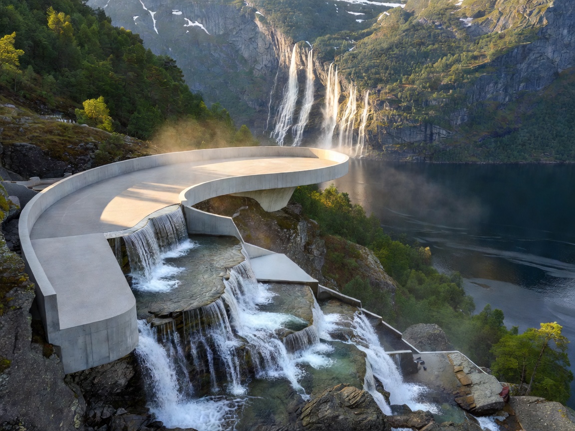
To the north, the Eagle Road (Ørnevegen) scales eleven consecutive switchbacks from sea level up to 620 metres. At its uppermost curve sits Ørnesvingen, an observation installation completed under the National Tourist Routes program. Designed by 3RW Arkitekter, the structure cantilevers over the drop with polished concrete slabs and an integrated water basin that conduits alpine run-off through the terrace flooring before discharging it into the abyss below.
Photographic Profile: Ørnesvingen vs. Flydalsjuvet
Both viewpoints provide dramatic side-views of the UNESCO World Heritage landscape, but their orientation and optical geometry differ substantially:
| Parameter | Ørnesvingen (Eagle Bend) | Flydalsjuvet |
|---|---|---|
| Elevation | 620 metres (2,034 ft) | 310 metres (1,017 ft) |
| Fjord Bearing | Looking West/South-West down the fjord | Looking North toward the village basin |
| Key Visual Landmarks | De syv søstre (Seven Sisters), Knivsflå farm | Geiranger cruise basin, steep fjord mouth |
| Optimal Lighting | Late afternoon & golden hour (westering sun) | Mid-morning (eliminates deep valley shadows) |
| Parking Capacity | Approx. 18 light vehicles; limited coach bay | Upper & lower parking areas; 40+ vehicles |
At Ørnesvingen, the viewer stands perpendicular to the Seven Sisters waterfall (De syv søstre), whose seven distinct ribbons cascade down a 410-metre vertical face. The side-angle view illuminates the abandoned farmstead of Knivsflå, situated on an impossibly steep ledge 250 metres above the tide line. Without this cross-sectional vantage, the historic human habitation of these sheer rock walls remains entirely hidden to valley-floor observers.
Roadway Characteristics & Transit Logistics
County Road 63 is characterized by severe gradients averaging 10% along both the northern (Ørnevegen) and southern (Flydalsjuvet to Dalsnibba) segments. Motorists operating manual transmission vehicles, heavily laden camper vans, or commercial coaches must exercise steady gear deceleration to avoid brake fade during descent.
Pros and Cons for Independent Travellers
- Unobstructed lateral depth: Ørnesvingen offers the only roadside vantage where the bend of Geirangerfjord is visible along its primary maritime channel.
- Architectural integrity: High-grade stainless steel balustrades and safety glass ensure child and pedestrian protection without impeding optical sensors or tripods.
- Severe midday congestion: Between 11:00 and 15:00 in peak summer months (June through August), tour coach arrival can cause temporary queues on the hairpin approach.
- Weather vulnerability: Low-hanging maritime cloud layers can completely occlude the fjord floor even when regional coastal forecasts predict fair conditions.
Seasonal Parameters & Navigation Protocol
While Ørnevegen is classified as a year-round route maintained by the Norwegian Public Roads Administration (Statens vegvesen), severe winter storms or localized avalanche warnings can result in short-term closures between November and April. In contrast, the southern pass toward Grotli and Dalsnibba closes predictably for winter, usually sealing between late October and late May. For side-view landscape enthusiasts, late May to mid-June supplies the highest waterfall volume, fueled by high-plateau snowmelt.